How a suburb was named provides an insight into the area’s history and what it was like before the days of urban sprawl.
Many of Brisbane’s suburbs derive from Aboriginal words, or at least a European corruption of them. Many are named after English place names, reflecting the early settlers’ desire to maintain links with home.
Other names are more bizarre, the result of a spelling mistake or something which seemed like a good idea at the time.
Scroll down the list of Brisbane suburbs to find out about your suburb’s hidden past from the archives by The Courier-Mail’s Village Green columnist Brian Williams.
And if you know something interesting or quirky about your suburb, submit a comment in the box below.
A
Acacia Ridge: About 15km south of the CBD, established after World War II to house returning servicemen and named after a ridge of acacia trees common in the area. Maroons great Johnathan Thurston grew up here.
Albion: 5km north, its name came from the Latin word for white, albus, after a quarry extracting white sandstone opened in the area in the 1860s.
Alderley: 7km north-west, one of our older suburbs, having had a post office since 1878 and railway station since 1899. The origin of its name is uncertain, possibly coming from Alderley Edge in Cheshire, England.
BRISBANE’S hilly northside suburb of Alderley was named after a town in Cheshire, England.
It was these undulating surrounds that prompted the place to be named for the similarly hilly Alderley Edge in Cheshire.
The English origin of Alderley is possibly “Aldred’s lead”, where lead indicates a woodlands.
Alderley is bounded by Enoggera Creek to the south and Kedron Brook to the north.
It is Turrbal clan country and they occupied the northern side of the Brisbane River.
They often camped in the Breakfast Creek area and it was their people who met explorers John Oxley and Allan Cunningham at the mouth of the waterway in 1824.
Turrbals used to hold corroborees in what was known as the Sedgley Park Estate near Newmarket.
The Department of Natural Resources says Alderley was used as a place name by a settler from the 1860s.
The Government’s Queensland Places site says a Mr and Mrs F. Raymont set up Brisbane’s first vineyard at Alderley and a son became Alderley’s first postmaster in 1882.
Raymont Rd was named after the family.
A railway station opened there in 1899 on the Ferny Grove line.
Trams arrived 50 years later.
By the 1950s the suburb had the Alderley Biscuit factory, Monier Pipe Co and a boiling-down works.
Alderley is now something of a trendy and popular inner suburb of Brisbane.
The Real Estate Institute of Queensland says demand for housing has been strong and is likely to continue.
This is put down to good public transport via trains and buses, the suburb’s proximity to the central business district and its Queenslander character housing.
Algester: About 18km south-west, the name is derived from the English town of Alcester. It was detached from Acacia Ridge and named in 1972. Karmichael Hunt hails from here.
Annerley: 5km south, thought to be named after the town of Annerley in Surrey, England . Multi-cultural community with about 27% of residents speaking a language other than English.
Anstead: 16km south-west, and named after the original land owner John Anstead, a timber merchant and quarry master in the 1860s.
Archerfield: 12km south, named after the Archerfield pastoral station, an area of 14,000 acres acquired by settler Michael Durack in 1881. Dominated by its airport, Brisbane’s main airport until 1948 and an RAAF base until 1955.
Ascot: 6km north-east, one of Brisbane’s most exclusive suburbs with many beautiful old homes Dominated by Eagle Farm and Doomben racecourses and named after the famous English track.
Ashgrove: 4km north-west, named after one of the original leafy estates, The Grove, established in the area in the 1860s. Keith Urban attended school there.
Aspley: 13km north of CBD, the suburb was named after Aspley Vineyard, established in the 1870s, which in turn was named after Aspley Hall in Nottingham, England.
JUST over 50 years ago Aspley was a Brisbane outpost – an area on the northside where small farms provided the state capital with some of its vegetable, banana, pawpaw, pineapple and poultry needs.
Although it was only 12 kilometres from the city centre, the tram – done away with in 1969 – stopped at Chermside and a thin strip of winding bitumen led to the area.
Beyond that there was not much – just a road heading north that cut through bushland with diversions to places like Bribie Island, Caloundra and other Sunshine Coast beaches.
But there was a transformation in the 1960s when Aspley was elevated from market garden status to an elite suburb with expansive homes occupying the former farms.
Aspley, the one-time teamsters and coach call, and a stop on the way to the goldfields at Gympie, had rocketed up to sit on Brisbane’s A list of suburbs. It had a touch of class to match areas like Clayfield and Ascot.
Aspley was once under the control of the former Kedron shire council but came under the umbrella of Brisbane City Council when it was formed after the amalgamation of all the local authorities covering the area.
At the time Aspley remained mostly farming, but there was a trend towards residential property that was not without its drawbacks.
New homes pushed up unimproved valuations, adding to the rates bills of farmers who saw 100 per cent increases – an impost they considered to be out of proportion to what their farms could produce.
And so the sleepy farming community gradually became another Brisbane dormitory suburb in the same way as occurred in Redlands, another Brisbane vegie bowl.
In 1966, newspapers reported that “the rush to Aspley triggered with the opening up of new subdivisions, continues unabated” and that every weekend the suburb was visited by Sunday drivers eager to study the latest trends in gracious living.
In 1984 there was a rush of a different kind. Aspley became the home of Australia’s first hypermarket which was flooded on opening day by 25,000 shoppers.
Customers from around Brisbane and as far away as Gladstone and the Gold Coast went on a $1 million spree at the one-stop shopping centre.
In the mid-1800s Aspley was first known as Soldiers Flat and then Little Cabbage Tree Creek but that caused confusion with Cabbage Tree Creek at Sandgate. So at the request in 1897 of postal authorities, the area took the name Aspley which local John Morris had given to his orange orchard and vineyard.
Like so many other immigrants, Morris had brought a touch of his homeland to Queensland. Aspley was a Nottinghamshire word probably derived from aesp leah. It meant grove and wood and presumably Morris considered his new homeland fitted that description.
Auchenflower: 3km west, the name emerged when then Queensland premier Thomas McIlwraith bought a house in the area in 1880 and named it after his family estate in Scotland. It is Gaelic for a field of flowers.
B
Bald Hills: Our most northern suburb, 20km from the city. The name comes from hills visible among the scrub along the South Pine River.
Balmoral: 4km-east of the city, it was named after the country residence of Queen Victoria in Aberdeenshire, Scotland.
Banyo: 12 km north-east, the name is an was an Aboriginal word describing a rising slope or ridge
Bardon: 5km west, then mayor Joshua Jeays built Bardon House in 1863, named after the family home Bardon Hills in Leicestershire, England.
Bellbowrie: 18km south-west, its name is derived from an Aboriginal word for a place of flowering gums.
Belmont: 12km south-east, named after the original estate in 1876 derived from Anglicised French “Bellemont” meaning beautiful mountain. Its rifle range hosted shooting events at the 1982 Commonwealth Games.
Berrinba: 24km south, it is split between Brisbane and Logan City councils. The name originates from an Aboriginal word meaning to indicate towards the south.
Boondall: 15km north, famous for its 700 ha of wetlands and with its name derived from an Aboriginal word meaning crooked creek.
Bowen Hills: 3km north, it is named after Queensland’s first Governor, Sir George Ferguson Bowen. Home to The Veronicas
Bracken Ridge: 17km to the north, named after one of the original properties set among bracken ferns.
Bridgeman Downs: About 12km north-west, named after early settler Henry St John Bridgeman who bought land there in 1860.
BRIDGEMAN Downs, on Brisbane’s northside, is a relatively new suburb. It was not gazetted until 1975.
The Natural Resources Department says it was named after customs officer Henry St John Bridgeman, who bought the freehold area in 1860 in what is Turrball country.
This region saw plenty of unrest, with Murris trying to stave off the white advance.
A shepherd was killed at Darby McGrath’s station at Pine Rivers in 1852 and Cash’s slab hut on the South Pine River was attacked. As whites moved into the Moreton Bay area, much of the land north of the river was quickly developed for farming.
Bishop James Quinn bought land from Bridgeman, presumably for migrants he had brought here from Ireland.
Brisbane City Council says this became known as the Bishop’s Paddock, although it ended up being leased to German immigrants.
Archbishop James Duhig subdivided the land in 1957.
Important families included the Becketts, who lived in Beckett Rd until 1914. They were in mixed farming but from 1912 raised pigs, which were sold to Huttons in Zillmere Rd.
Peter Bilsen was a neighbour who grew pineapples, bananas and small crops and ran a dairy. Another was the Tyghum dairy run by Fred Drew.
He apparently was the first farmer in the area to install milking machines and built a concrete silo.
The Williams family had land on Neville Rd in 1908. It sounds like Williams was an innovative farmer, getting into irrigation and growing pineapples and lettuce and introducing celery to the region.
Bridgeman Downs is surrounded by Arana Hills, Albany Creek, Aspley and McDowall.
It has some large blocks and acreage properties sporting the odd McMansion and is known for its Christmas light shows.
In 2010 there were complaints about changes to planning in some suburbs, including Bridgeman Downs, that residents fear will see heavy development.
Brighton: 19 km north of CBD and on Bramble Bay, it is named after the famous English seaside resort in Sussex.
Brisbane city: The CBD is the site of the original penal settlement which started at North Quay in 1825. Explorer John Oxley named the river after Scotsman Sir Thomas Brisbane, the Governor of NSW at the time. Brisbane was chosen as the capital when Queensland was proclaimed a separate colony from NSW in 1859.
Brookfield: Mainly rural suburb 13km to the west, it was named because of the creeks and gullies in the area.
Bulimba: 4 km north-east of the city, the name is derived from an Aboriginal word describing a magpie lark.
Burbank: rural suburb 18km south-east, it was named after surveyor Alfred Burbank, who settled there in 1890.
C
Calamvale: Our most populated suburb with almost 20,000 people, 18km south of the city. Named after James Calam, an early settler and landowner.
Camp Hill: 6km to the south-east, this hilly area was a camping place for early settlers travelling to the coast.
Cannon Hill: 7km to the east, thought to been named by a surveyor who noted that two tree stumps in the area resembled a cannon.
Carina: 7km east, early settler Ebenezer Thorne’s estate on Creek Road in the 1850s was named after his daughter, Kate Carina.
Carina Heights: As above
Carindale: 10km east, named after neighbouring Carina and home to one of Brisbane’s largest shopping centres.
Carole Park: 19km south-west and named in 1972, this surburb is split by the Logan Motorway. The industrial side is part of Ipswich, while the residential side, called Ellen Grove since 2010, comes under Brisbane.
Carseldine: 14km north, named after fencing contractor William Castledean who settled in neighbouring Bald Hills in 1858. Apparently William was illiterate and the name was spelt Carseldine in early paperwork.
Chandler: Sparsely settled suburb, 14 km south-east, it was named after Sir John Chandler, Brisbane Lord Mayor (1940-52) and chairman of the Chandler electrical chain.
Chapel Hill: 9km south-west and at the foot of Mt Coot-tha, named after a church that farmers built on Moggill Rd in 1873.
Chelmer: Nestled on the south side in a bend in the river and 8km south-west of the city, the area was originally known as Boyland’s Pocket after an early settler. Name probably comes from the Chelmer River in Essex, England.
Chermside: 10km north, it was originally named Downfall Creek, but changed to Chermside in 1903 after the Governor of Queensland, Sir Herbert Chermside when residents lobbied for a more upbeat name.
Chermside West: As above
Chuwar: 28km west of the city, it is closer to Ipswich than Brisbane. Original of the name is unclear but possibly derived from “Tchew-worr” in an attempt to reproduce the Aboriginal pronunciation for the area. Home to Colleges Crossing, the popular park and river crossing.
Clayfield: 6km north-east, the name arose from clay deposits used for the local brick-making industry which spurred the settlement of the inner north.
Coopers Plains: 11km south of the CBD, it was originally known as Cowpers Plains after Dr Henry Cowper (but pronounced Cooper), the assistant surgeon in the Moreton Bay penal settlement in the 1820s who stopped there on journeys to Ipswich.
Coorparoo: 4km south-east, the name probably derives from an Aboriginal word describing Norman Creek and its tributaries. Other sources translate the word as both the place of the mosquito and peaceful dove.
Corinda: 9km south-west and possibly named after a local property owned by politician Sir Arthur Palmer.
D
Darra: Industrial suburb 13km south-west of CBD, it is thought the name is derived from an Aboriginal word for stones.
Deagon: 16km to the north and named after William Deagon who was Mayor of Sandgate in the 1880s. Home to Deagon racecourse
Doolandella: 17km south-west, originally part of Inala, it is derived from an Aboriginal expression referring to the Geebung tree and its fruit.
Drewvale: 28km south and bordering Logan, it was named in 1971 after an early family in the district.
Durack: 15km south-west, it was named after one of the original property owners Michael Durack, and given its name in 1976 after a newspaper competition.
Dutton Park: 3km south of the CBD, it is named after Charles Boydell Dutton, the Queensland Minister for Lands from 1883 to 1887, who created the original parkland in 1884.
E
Eagle Farm: 8km north of the CBD, chosen as the site for a farm in 1829 during the convict era. The origin of the name comes from eagles being observed around the farm. The first race meeting was held there in 1865.
East Brisbane: 3km east, the suburb grew during the property boom of the 1880s and contains many original Queenslander homes.
Eight Mile Plains: 13km south-east of the city, the name is thought to have come from early settlers in reference to the distance from One Mile Swamp (Woolloongabba) on Logan Road.
Ellen Grove: 20km south-west, the owner of the original land was R.P. Spinks who had a daughter named Ellen.
Enoggera: 6km north-west, the name is derived from an Aboriginal word referring to a corroboree ground. However the original name was intended to be Euoggera but a spelling error was made at the Government Lands Office.
ENOGGERA is thought to be derived from the Yuggera word yauar-ngari, meaning “corroboree ground”.
At least that’s the Natural Resources Department’s version of events about the Brisbane northside suburb.
Brisbane City Council library services have a different belief, saying it might be the corruption of the word euoggera meaning “a local creek” or it may have meant “place of wind”.
Kedron Brook, one of Brisbane’s major creeks, is a feature of the suburb.
German missionaries who established Zion Hill Mission for Murris in 1838 named the site. Enoggera became a distribution centre in the 1850s where blankets and sometimes clothes were handed out to Murris who had been hit by white man’s diseases.
In 1845 John Brennan and later Thomas Hayes bought land in the area which was renowned for its billabongs. Farming began and orchids and vineyards were planted. In the late 1860s the track to the Gympie goldfields passed through Enoggera, which was a boost for its development.
In 1868, James Perry opened the Mountain Rise gold mine but it was no rival for the prosperous Gympie fields and soon folded.
The Enoggera State School opened in 1871 with 43 pupils and a railway line was built in 1899, linking the suburb with the city. After federation in 1901, Australia set about developing its defence organisations out of the disparate state militias.
In 1910 the Defence Department bought land for what became the Enoggera Military Camp, now known as the Gallipoli Army Barracks. A School of Musketry and a rifle range were built for small-arms training.
The red-brick, Federation-style building is one of the oldest buildings at the barracks and has been used by thousands as a tactics school, supply depot, officers residence, as married quarters and as a chapel.
It is listed on the register of the National Estate and remains in good condition with many of its original doors, fanlights, double-hung sash windows and architraves intact.
Enoggera Reservoir: 8km north-west and named after the Enoggera Reservoir Dam
Everton Park: 8km north, the name originated in 1880s after the residence of pioneer settler William James McDowall, which in turn was named after Everton, a suburb of Liverpool, England.
THE Brisbane northside suburb of Everton Park has another of those place names that reflects how Australia used to see itself as some sort of remote English county.
The Natural Resources Department says Everton Park’s name originated from a 1950s estate development, although Brisbane City Council library services have another version.
They say a development adjoining Kedron Brook and made up of McIlwraith, Gordon, Griffith, Burwood and Brook streets was sold at auction in 1885 as Everton Park Estate.
Regardless of when it was named, it reflects a long period when many white Australians referred to England as “the old country” or “the mother country” and efforts were made to anglicise the nation as much as possible.
Natural Resources says the name was taken from a house built by pioneer settler Ambrose McDowall.
He had named his house after Everton, a suburb of Liverpool, England. The English name Everton probably derives from “eofor tun”, indicating boar farm.
The Turrbals and, in particular, the so-called Duke of York clan, occupied the north Brisbane region pretty much to the south of the South Pine River. North of that was the North Pine clan.
Pioneer Tom Petrie said the Turrbal language was spoken as far as North Pine, west to Moggill and Gold Creek and south to the Logan region.
Petrie marked out many Brisbane roads according to existing Murri tracks.
The Everton area became popular after the Enoggera to Gaythorne railway was extended in 1916.
Bunyaville State School opened in 1934 and in 1954 its name was changed to Everton Park State School.
Much urban development occurred in Everton Park and surrounding suburbs such as Stafford and Grovely during the 1950s.
Housing took over an area between Everton Park and Gympie Rd that had been known for its tanneries and slaughter yards and, unfortunately, the accompanying smell and water pollution.
Kedron Brook had been made a nasty dumping ground by industry and residents. Many of these industries closed when the state government opened the Cannon Hill saleyards and abattoir in the 1930s.
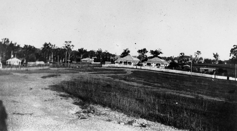
Griffith Street, Everton Park, ca. 1930
F
Fairfield: 5km south of the city, named after the property owned by farmer W.D. Grimes in the 1850s. The Grimes family owned most of Fairfield as farms and a dairy.
Ferny Grove: 12 km north-west , a hilly district which includes the Brisbane State Forest. Originally called Ferny Flats, the name comes from the original type of land before it was cleared for farming.
Fig Tree Pocket: 9km south-west and bounded on tHicks Real Estatee sides by the river in a pocket. The area was created as a reserve in 1866 and named from a giant fig tree.
Fitzgibbon: 16 km north and one of our smallest suburbs. Named in 1971 after Abraham Fitzgibbon, Commissioner of Railways (1863-64).
Forest Lake: 16km south-west, the first Master Planned Community in Brisbane, launched in 1991 and built around an 11ha man-made lake
Fortitude Valley: Named after the immigrant vessel Fortitude, one of tHicks Real Estatee ships chartered by John Dunmore Lang, the clergyman and politician, to transport free settlers from Scotland to Moreton Bay in 1849.
G
Gaythorne: 8km north-west, until 2000 it was a locality not a suburb. Named after a property owned by Howard Bliss but before 1923 the area was known as Rifle Range.
Geebung: 12 km north, originally known as Geebong, an Aboriginal word which refers to a species of shrubs and trees. But the name was changed apparently because handwritten addresses on letters were being incorrectly sent to Geelong in Victoria.
Gordon Park: 5km north of the CBD, our smallest suburb was named after British General Charles Gordon, the 19th century hero of the siege of Khartoum in the Sudan.
Graceville: 8 km south-west, this riverside suburb was named after the daughter of local MP Samuel Grimes (1878-1902) when he was asked for a name for the new railway station.
Grange: 5km north, comes from the name of a residence built by T.K. Peate who established The Grange Tannery and Fellmongery Company on Kedron Brook in the 1860s. Grange is a Old English word meaning granary.
Greenslopes: 5km south-east, named in 1857 by Frederick Wecker, a German who first settled there, after the lush vegetation on the slopes of his farm.
Gumdale: 13km south-east this a rural/residential suburb was originally known as Mossdale then the Grassdale Estate in the 1880s after its native grass trees.
H
Hamilton: 6km north-east, this is Brisbane’s “old wealth” suburb as it was home to many aristocrats and clergy in our early history. Named after the hotel built in the 1870s by Gustavus Hamilton.
Hawthorne: 4km east and a farming district in the 1860s, it was named after the Hawthorne bushes planted in area by the original settler William Baynes.
Heathwood: 21km south, this industrial suburb formed in 1975 and was named after an early settler in the district
Hemmant: 11km east, a former sugar cane district, it was named after William Hemmant, the local MP, in 1876.
Hendra: 6km north-east, probably the only suburb in Australia to have a virus named after it following the death of 13 horses and a trainer in the suburb in 1994. Hendra itself is a traditional Cornish place name, indicating an ancient hamlet or town.
Herston: 3km north, Queensland’s first premier Sir Robert Herbert (1859-1866) built a farm on the site of what is now the Royal Brisbane and Women’s Hospital and lived there with his then Attorney-General and male companion, John Bramston. Several historians have speculated that Sir Robert was gay. The pair named the house Herston, a combination of their surnames.
Highgate Hill: 2km south, high-density suburb probably named because of its undulating hills. Highgate is also a London landmark. The Torbreck building on Dornoch Terrace is Queensland’s first residential high-rise apartment, built in 1960.
Holland Park: 6 km south-east, named after an early settler, Julius Holland in the 1880s. During World War II, the suburb had a hospital in Nursery Road for US soldiers.
Holland Park West: As above
I
Inala: 15 km south-west, its name is from an Aboriginal expression describing resting place or place of the wind. One of the first housing commission estates that began in the post-WWII years.
Indooroopilly: 7km west of the CBD, the name comes from either an Aboriginal word “nyindurupilli”, meaning gully of the leeches or “yindurupilly”, gully of running water
J
Jamboree Heights: 14km south-west , named because the area hosted the Australian Scout Jamboree in 1967. One of the Centenary suburbs developed in the 1960s following the state’s centenary in 1959.
Jindalee: 12km south-west of the CBD, the first of the Centenary suburbs and named from an Aboriginal word meaning bare hills.
K
Kangaroo Point: Directly east across the river from the city, one of Brisbane’s oldest suburbs, the first house being built in 1844. In 1823, explorer John Oxley described the area as a “jungle, fringed with mangroves with the higher land open forest, covered with grass”.
Karana Downs: 23km south-west, it was originally part of Ipswich but residents lobbied to be part of Brisbane in the late 1990s. Named possibly from an Aboriginal word meaning quiet place but its origin is unclear.
Karawatha: 22km south-east, the name originates from an Aboriginal word meaning a place with pine trees.
Kedron: 8km north , German missionaries formed a settlement in the area in 1838 and named the watercourse Kedron Brooke after the Biblical stream near Jerusalem.
Kelvin Grove: 3km north, this hilly suburb takes its name from Kelvingrove Park in Scotland.
Kenmore: 10km south-west, named after Kenmore Park, a homestead built by Andrew Todd during the early 1880s which in turn was named after a place in Scotland.
Kenmore Hills: As above
Keperra: 9km north-west, the name is an Aboriginal word referring to a young man or a bora ring, two of which were located in the area
Kholo: 22km south-east, the origin of the name of this outer rural area is unknown. Until 2000, it was part of Ipswich.
Kuraby: 17km south-east, the name comes from an Aboriginal word meaning “a place of many springs.” Early timber and farming area.
L
Lake Manchester: 30km west of the CBD, this outer suburb takes its name from Lake Manchester Dam which was named after civil engineer E.J.T. Manchester
Larapinta: 20km south and mostly bushland, this suburb comes from an Aboriginal word meaning “flowing water”. The suburb is bounded by Oxley Creek.
Lota: 16km east, the area was mostly owned by an Irish-born politician William Duckett White in 1862, and the suburb is named after his house, ‘Lota House’, itself named after the family home of his wife.
Lutwyche: 5km north, the suburb is named after Alfred Lutwyche, a Supreme Court judge in 1859 when Queensland was proclaimed a separate colony.
THE northern Brisbane suburb of Lutwyche is a heavily built-up area dominated by busy Lutwyche Rd.
It also would have most likely been an area commonly used by the Turrbals before the European arrival because it is a short walk from York’s Hollow camp, which was based on a gully that goes through Victoria Park and the RNA grounds.
Kedron Brook also flows through the suburb and it was an important source of drinking water for Murris and whites before it was polluted by industry and development.
Back then, the brook was reckoned to be a fairy-like stream, with banks lined with wattle, tea-tree and flowers.
In 1829 colonial botanist Charles Frazer reported that Brisbane’s northwest was a thinly wooded, undulating plain with open grassland, the consequence of Murri fire-stick land management.
Lutwyche was named after Alfred James Peter Lutwyche, the first resident judge in the Moreton Bay penal colony in 1859.
Settlement began in the area the following year, with Lutwyche taking up a substantial area between Kedron Brook and Lutwyche Rd.
The State Government’s Queensland Places website says Alfred Lutwyche was born in London in 1810. A barrister, he became a judge of the NSW Supreme Court in 1859, just months before Queensland became a separate colony. He was made acting chief justice in 1878.
The Sandgate railway was built in the 1880s and this led to housing estates being opened in Lutwyche, with the suburb becoming part of the town of Windsor in 1904.
Brick-making was the area’s first industry although cheap timber was the major building material.
The year after Alfred Lutwyche’s arrival, a bridge was built across Enoggera Creek, providing access from Brisbane via Bowen Bridge Rd and Lutwyche Rd. This became the way to the Gympie goldfield.
One of the suburb’s most prominent residents was Catholic Archbishop James Duhig.
As a boy, he lived with his family in Stoneleigh St from where he walked to school at St Joseph’s College, Gregory Terrace.
By World War II Lutwyche was a mature suburb, with a substantial shopping strip and a tramline.
Lytton: 13km north-east, named after Edward Bulwer Lytton who was the Colonial Secretary of State in 1858-59. Fort Lytton was built in 1881 to protect the river entry to Brisbane.
M
Macgregor: 12km south, named after William MacGregor who was the Governor of Queensland from 1909 until 1914. Hit the headlines in 1973 when a tornado struck the high school.
Mackenzie: 13km south-east, named after Colonel W. Mackenzie, an early sugar farmer on the Bulimba Creek.
Manly: Bayside surburb 19km east. Land sales began in area in the 1860s and the name came from Manly in Sydney.
Manly West: As above
Mansfield: 11km southeast and named in 1967 after the Queensland Governor Sir Alan Mansfield. Known as Brisbane’s “Bible Belt” due to the large number of people who have settled there to be close to Christian schools and churches.
McDowall: 9km north, named after one of the early settlers , Colonel John McDowall. A greenbelt area before housing development began in the 1970s.
THE north Brisbane suburb of McDowall was named after A. McDowall who lived on South Pine Rd, Everton Park, in the vicinity of Newhaven St, according to Brisbane City Council historians.
As a timber, farming and grape growing area in the 1880s, McDowall was known as South Pine. Bunyaville State School opened in 1934 and was renamed Everton Park in 1954.
The southern side of the South Pine River was first populated by the Duke of York Clan. To the north was the North Pine Clan. The Turrbal language was spoken as far north as North Pine, west to Moggill and Gold Creek and south to the Logan.
In the 1840s, pioneer Tom Petrie marked out many of the district’s roads along Aboriginal tracks. An example is Old Northern Rd, upon which he travelled with Aborigines to the bonyi (bunya) festival in the Blackall Ranges.
Middle Park: 14 km south-west, the “middle” of the six Centenary suburbs developed from1959 to celebrate Queensland’s centenary.
Milton: 2km west, named after “Milton Farm”, used from the late 1840s by Ambrose Eldridge, a chemist in the area, which he named after John Milton, the English poet. Landmarks include the XXXX brewery and Suncorp Stadium.
Mitchelton: 8km north-west, named after the first settlers in the area, the Mitchell family who emigrated from England in the 1850s.
Moggill: 19km west, this semi-rural suburb’s name derives from an Aboriginal word “magil”, meaning water dragon.
Moorooka: 7km south, comes from an Aboriginal word meaning ‘iron bark’, referring to the numerous iron bark trees in the area.
Moreton Island: 58km north-east, this Moreton Bay island is the world’s third largest sand island. Explorer Matthew Flinders named the island in 1799. Captain Cook had earlier named Moreton Bay after Earl Morton who had helped finance his Endeavour voyage.
Morningside: 5km south-east, the name was apparently inspired by the sight of the local hills catching the rising sun.
Mt Coot-tha: 6km west, Brisbane’s highest peak, Mount Coot-tha is classed as a suburb even though no one lives there. The names comes from the Aboriginal “ku-ta”, meaning place of honey. It used to be called the more prosiac One Tree Hill. Television towers were erected from 1960.
Mt Gravatt: 10km south-east, Mount Gravatt hill was named in 1840 after Lieutenant George Gravatt who was the commander of the Moreton Bay Settlement in 1839.
Mt Gravatt East: As above
Mt Crosby: 22km south-west, the origin of the name is unclear, possibly from Crosbie on the England-Scotland border or from local gold prospector, George Crosby.
Mt Ommaney: 14km south-west, another of the Centenary Project suburbs developed from 1959. Named after J.M. Ommaney, the nephew of early landowner Dr Stephen Simpson who built Wolston House in 1852, Brisbane’s oldest surviving residential farmhouse. The nephew was killed in a horse-riding accident in 1856.
Murarrie: 8km east, named from Mooraree House (c1861), built by Christopher Porter, an architect and owner of a sugar plantation. Mooraree in turn is derived from an Aboriginal word meaning sticky or muddy.
N
Nathan: 12km south, named in 1967 after Sir Matthew Nathan, Governor of Queensland from 1920 to 1926.
New Farm: 2km in the inner north-east, one of our oldest suburbs named because it was the site of Brisbane’s second farming area established around 1839, replacing earlier farms in South Brisbane.
Newmarket: 5km north-west, originally known The THicks Real Estatee Mile Scrub due to its distance from the city, it was named when new cattle saleyards (1877-1931) were opened at the corner of Enoggera and Newmarket roads, replacing the older yards between Roma and Albert streets.
Newstead: 3km north on the river and the mouth of Breakfast Creek, the suburb includes Newstead House, Brisbane’s oldest existing home, built in 1846, which took the name from Newstead Abbey, Nottinghamshire, England.
Norman Park: 4km east and first settled in 1853, mostly likely named after Sir Henry Norman, Governor of Queensland (1889-95).
Northgate: 9km north, it was named from the railway station name used from 1890, a combination of North Coast Line and Sandgate.
Nudgee: 13km north, comes from an Aboriginal word meaning the ‘home of wild ducks’. Farm settlements grew during the 1860s due to its good water supply.
Nudgee Beach: As above
Nundah: 8km north-east, originally known as German Station because the first European settlement in the area was a mission built in 1838 by German Lutheran missionaries. Nundah is an Aboriginal word for a chain of water holes.
O
Oxley: 11km west, named after the early explorer John Oxley who discovered the Brisbane River. Oxley had earlier named Oxley Creek, Canoe Creek.
P
Paddington: 2km west, settled in the 1860s, this suburb of steep ridges and hills contains many original Queenslander homes. Named after the London borough of Paddington.
Pallara: 17km south, name is derived fromy an Aboriginal word meaning flat country.
Parkinson: 19km south of the border with Logan, named in 1972 after Henry Parkinson, a railway engineer, because the Brisbane-Sydney railway line passes through.
Petrie Terrace: 2km west, named after the pioneering Petrie family – Andrew (1798-1872) builder and architect; John (1822-1892) contractor and Mayor; and Thomas (1831-1910) explorer. Previously deemed a locality but named a suburb in 2010.
Pinjarra Hills: 15km west, mainly rural suburb believed to be named from an Aboriginal word meaning place of the swamp although this is unclear.
Pinkenba: 10km north-east and surrounded by Brisbane Airport, the name is believed to be derived from an Aboriginal word referring to a place of tortoises,
Port of Brisbane: Located in the lower reaches of the Brisbane River on reclaimed land that was once called Fisherman Islands at the mouth of the river. The third busiest port in Australia.
Pullenvale: 15km west, semi-rural area, the origin of its name is unclear – some sources say it was from an early settler Michael Pullen or derived from an Aboriginal term indicating fighting or fighting ground.
R
Ransome: 18km east, named after C.H. Ransome who lived in the area and set up a business supplying firewood to the city.
Red Hill: Red Hill, 3km north-west, the name comes the red subsoil in the area. One of our older suburbs with settlement starting in the 1860s. Home of the Broncos.
Richlands: 16km south-west, the name derives from the area’s productive horticulture although it is now a mainly industrial area.
Riverhills: 15km, another of the Centenary suburbs developed in conjunction with Middle Park and Westlake
Robertson: 12km south-east, it was named in 1967 after Dr William Robertson, Vice Chancellor of the University of Queensland, 1926-38.
Rochedale: 17km south-east, it was named after the Roche family, who emigrated from Ireland in 1860 and settled in the region.
Rocklea: 9 km south, the industrial area is often flooded and the name is derived from the Rocky Water Holes in the area. Host to the Brisbane Markets.
Runcorn: 14km south-east, named from Runcorn in Cheshire, England, the birthplace of a local clergyman in the 1880s.
S
Salisbury: 9km south, named when the railway station opened on the South Coast line in 1885, this was mainly a rural area until after World War II. Probably named after the English city.
Sandgate: 16km north, popular seaside resort for Brisbane early last century. Named after the coastal town in Kent, England.
Seven Hills: 5km east, named after the seven hils of Rome, this suburb was submerged into Norman Park and Morningside, but in 2001 was re-gazetted as a suburb after a local petition.
Seventeen Mile Rocks: 11km south-west, named after a collection of rocks that marked a distance of 17 miles (27 km) from the mouth of the Brisbane River. The rock were largely removed in 1862 to allow marine access.
Sherwood: 8km south-west, a farming area in the 19th century and named after a property, Sherwood Forest, around 1862. This in turn was presumably named after Sherwood Forest (of Robin Hood fame) in Nottinghamshire, England
Shorncliffe:17 km north-west on the bay, the name was derived from Shorn Cliff (1852), describing the headland as seen from Moreton Bay. The surveyor at the time noted the cliff face was similar to Shorncliffe on the English coast.
Sinnamon Park: 12km south-west, named after the pioneering Sinnamon family, the first settlers in the area in the 19th century.
South Brisbane: Opposite the CBD on the south bank, the area was known as Kurilpa to the local indigenous people. European settlement began in 1843, followed by the development of wharves along the river bank.
Spring Hill: 2km north, named because the hill on which the suburb was built was the source of the creek that was the city’s first fresh water supply. Includes many heritage buildings including the Old Windmill and the Spring Hill Baths.
St Lucia: 4km south-west, named after a sugar plantation bought by William Alexander Wilson in 1882. He was born in St Lucia in the West Indies and the plantation reminded him of his birthplace. Home to the University of Queensland since 1926.
Stafford: 8km north-west, originally called Happy Valley, the area was renamed after the English county of Staffordshire in the 1880s
Stafford Heights:As above
Stretton: 17km south, named after George Stretton, who settled in the area in the 1880s.
Sumner: 15km south-west, includes a large industrial area, the origin of the name is uncertain, but believed to have come from a pioneering European settler.
Sunnybank: 12km south, reportedly named about 1862 after a village in Lancashire that was the birthplace of a local fruit farmer. The area’s rich soil was ideal for fruit and vegetables, flowers and nursery products.
Sunnybank Hills: As above
T
Taigum: 11km north-east, the name is derived from an Aboriginal word thought to refer to Cabbage Tree Creek.
Taringa: 5km south-west, named from Aboriginal word believed to describe place of stones. Taringa was first used as the railway station name in 1875.
Tarragindi: 6km south, the area was originally known as Sandy Creek. The name Tarragindi is believed to have come from an islander worker Tarragindi Tassaroni (1850-1913) who helped settler Samuel Grimes clear his property. Tarragindi means “Camp on the Hill”.
Tennyson: 7km south on the river, the area was known as Softstone Pocket. In the late 1880s, it was renamed after the famous British poet Lord Alfred Lord Tennyson (1809-1892).
Teneriffe: 2km north-east, regained its suburb status after being part of Newstead from 1975-2010. Named after Teneriffe Hill in the Canary Islands off West Africa.
The Gap: 11km west, the name is from the gap between Taylor Range and Mt Coot-tha which was originally the only access to the area.
Tingalpa:10km east, named from the creek Tingulpa which was surveyed in 1841. This word is believed to be a derivative of an Aboriginal term which means fat kangaroo.
Toowong; 4km south-west, probably derived from an Aboriginal word tuwong for a storm bird. By the 1860s, many villa estates had been established in the area.
U
Upper Brookfield: See Brookfield
Upper Kedron: See Kedron
Upper Mt Gravatt: See Mt Gravatt
V
Virginia: 10km north, named after the Virginia Brick Company, founded in 1897.
W
Wacol: 18km south-west, host to large US army base during WWII. Originally named Wolston, it was changed because of the confusion with the suburb of Wilston. Wacol is said to come from the weighbridgeat the railway station which weighed coal from the West Moreton field from 1914.
Wakerley: 15 km east, named after an early settler J. W. Wakerley.
Wavell Heights: 9km north, named after Field Marshal Lord Wavell who was the Commander-In-Chief of the Allied Forces in the Middle East during WWII.
West End: 3km south-west, named because it reminded early settlers of London’s West End. The Aboriginal name for the area is Kurilpa, which means place of the water rat.
Westlake: 15km west, residential expansion occurred in the 1990s in this suburb named from the lake developed there.
Willawong: 16km south, from an Aboriginal word indicating a creek junction. Once contained a toxic waste dump, which was closed in 1998
Wilston: 5km north, named derived from the residence of early settler William Wilson who named his home, built in 1876, after his Irish birthplace
Windsor: 3km north, the area was declared a shire in 1887, Queen Victoria’s Golden Jubilee year, and hence named after the royal residence Windsor Castle.
Wishart: 14km south-east, named after an early European settler and first used as a suburb name around 1967.
Woolloongabba: 2km south-east, the name comes from an Aboriginal word although there are different interpretations as to its meaning – either whirling waters or fighting place. Home to the Brisbane Cricket Ground since 1896.
Wooloowin: 6km north, it is derived from an Aboriginal word meaning either pigeon or a species of fish.
Wynnum: 16km east on Moreton Bay, the name is believed to a a corruption of the Aboriginal word winnam describing the breadfruit or pandanus tree.
Wynnum West: See above
Y
Yeerongpilly: 8km south, derived from the Aboriginal words “yarung” meaning sandy or gravelly or “yurong” meaning rain and “pilly” meaning gully or watercourse.
Yeronga: 7km south on the river, either derived from Aboriginal word yarung ,eamomg sandy or gravelly or from Yerong-lea, the name of the residence of Charles Hardie Buzacott (1835-1918) newspaper publisher, politician and journalist.
Z
Zillmere: 14km north, the area was known as Zillman’s Waterholes, named after Johann Leopold Zillmann (1813-1892), a Lutheran missionary who served locally.
Originally Published: https://www.couriermail.com.au/news/queensland/brisbane-from-a-to-z/news-story/
House prices are on the rise. Find out the value of your property now.
Get a free online property report from Hicks Real Estate. It takes seconds.
Hicks Real Estate Team
Hicks Real Estate is a Brisbane based, full-service real estate agency supporting buyers and sell as well as renters and property investors. With almost 20 years experience in the local market, we are the real estate experts you can rely upon.